





Trouble is Brewing Under the Ice: The PRC’s Use of Science to Gain Military Advantage in the Arctic

Abstract
The PRC’s security goals include denying the United States unchallenged freedom of maneuver under the Arctic ice and the northern approaches to the PRC’s home waters. The PRC is systematically using instruments of national power flexibly to gain access to scientific treaty memberships, enter denied areas via scientific missions, and obtain comprehensive seafloor topographic data through undersea mining, commercial undersea cable ventures, and clandestine mapping missions. The PRC will probably use any intelligence advantage to ensure that, when it chooses conflict, it does so with an undersea presence that is both technologically advanced and informed by extensive knowledge of undersea topography, sensor arrays, currents, and NATO/US tactics.
The People’s Republic of China’s declaration of its near-Arctic state status in 2014 signaled the PRC’s intentions to become an economic and security presence in the region. Scientific research provides a means by which the PRC pursues the systematic expansion of its operations in the Arctic, which it justifies by economic opportunity and scientific discovery. These same experiments and expeditions create openings for PRC military ventures. The PRC has moved rapidly to establish a presence in the Arctic, in conjunction with its global seafloor exploration and mapping. An analysis of where the PRC performs experiments and the nature of the equipment involved demonstrates a pattern of data collection with immediate military applicability. The PRC’s goals and strategic objectives are clear: an Arctic presence, access to resources, use of commercial sea lanes, and early warning of subsurface threats. Science will provide the PRC with data to achieve those strategic goals by offering a plausible, deniable rationale for PRC expeditions, tests, and seafloor data-gathering scans.
According to Puranen and Kopra, the official PRC strategy since President Xi announced China’s near-Arctic state status in 2014 has been to regard the Arctic region as “part of the ‘new security domains’ (新型安全领域) or “new strategic frontiers” (战略新疆域), in which great power competition was projected to be expanding in the near future.” China’s National Security Law, enacted in 2015, elevated the Arctic’s security status and underscored its importance to China’s economic and overall national security interests. The trend continued with the 2020 publication of The Science of Military Strategy, in which the PRC communicated its military’s Arctic future. Chinese strategy considers the polar regions to be strategic terrain on par with the ocean seabed or space. Further, the Arctic is “the main direction in which national interests are expanding,” with new missions for the Chinese military. Gaining access to resources and a security presence in the Arctic has an overarching strategic outcome that the PRC is working to ensure by mastering the Arctic surface and subsurface domains, including the seabed and the underwater cables that lie on it.
The PRC is advancing a security agenda that, if realized, will challenge United States and NATO access to the Pacific Ocean and the Arctic region’s surface and subsurface mobility corridors through the Bering Strait chokepoint and into the Arctic Ocean, while granting the PRC access to the same. The shallow waters of the strait and the vulnerability of ships and underwater vessels traversing the strait make it a natural choke point from which to detect and interdict vessels through a network of underwater sensors, unmanned underwater vehicles, unmanned surface vessels, and emplaced AI-enhanced seafloor weapons systems. Further, by leveraging data gathered by PRC research vessels and PLAN escorts, the PRC can use civil-military fusion to model potential engagement sites and locate vulnerable undersea cables for exploitation. Ultimately, Article 7 of China’s 2017 National Intelligence Law obligates every PRC citizen and research institution to provide information of intelligence value to the state. Data gathered in the name of science is subject to national security requirements, and the PRC uses it to advance in policy, intelligence, and military domains.
Scientific Expeditions Translate into Military Strategy and Targeting Opportunities
The Bering Strait chokepoint connects the Arctic Ocean and the Bering Sea. Averaging 30 to 50 meters deep with a maximum depth of 390 meters, the 53-mile-wide (44 nautical miles) strait is key terrain for any potential conflict between underwater naval forces in future conflict. Under the United Nations Convention on the Law of the Sea (UNCLOS), the data that scientific research collects must be for peaceful purposes. The UNCLOS also specifies that that states must grant permission for research, resource prospecting,, or exploration in their Exclusive Economic Zones (EEZs) or continental shelves. However, the United States rejects this position and conducts military surveys and routine oceanographic data collection. This presents the PRC with a justification for its own surveys and exploration based on United States practice. Unlike the PRC the United States makes its scientific findings available in open-access public databases like the National Oceanic and Atmospheric Administration web site, and European Union states make their Polar and marine data available through networks like Copernicus or EMODnet. The PRC does not share data and retains its scientific findings behind a civil-military fusion system that classifies scientific data. PRC science survey results are used for territorial disputes and to claim resources in disputed areas. Further, the PRC conducts survey missions with a public justification that doesn’t match actual ship movements or locations.
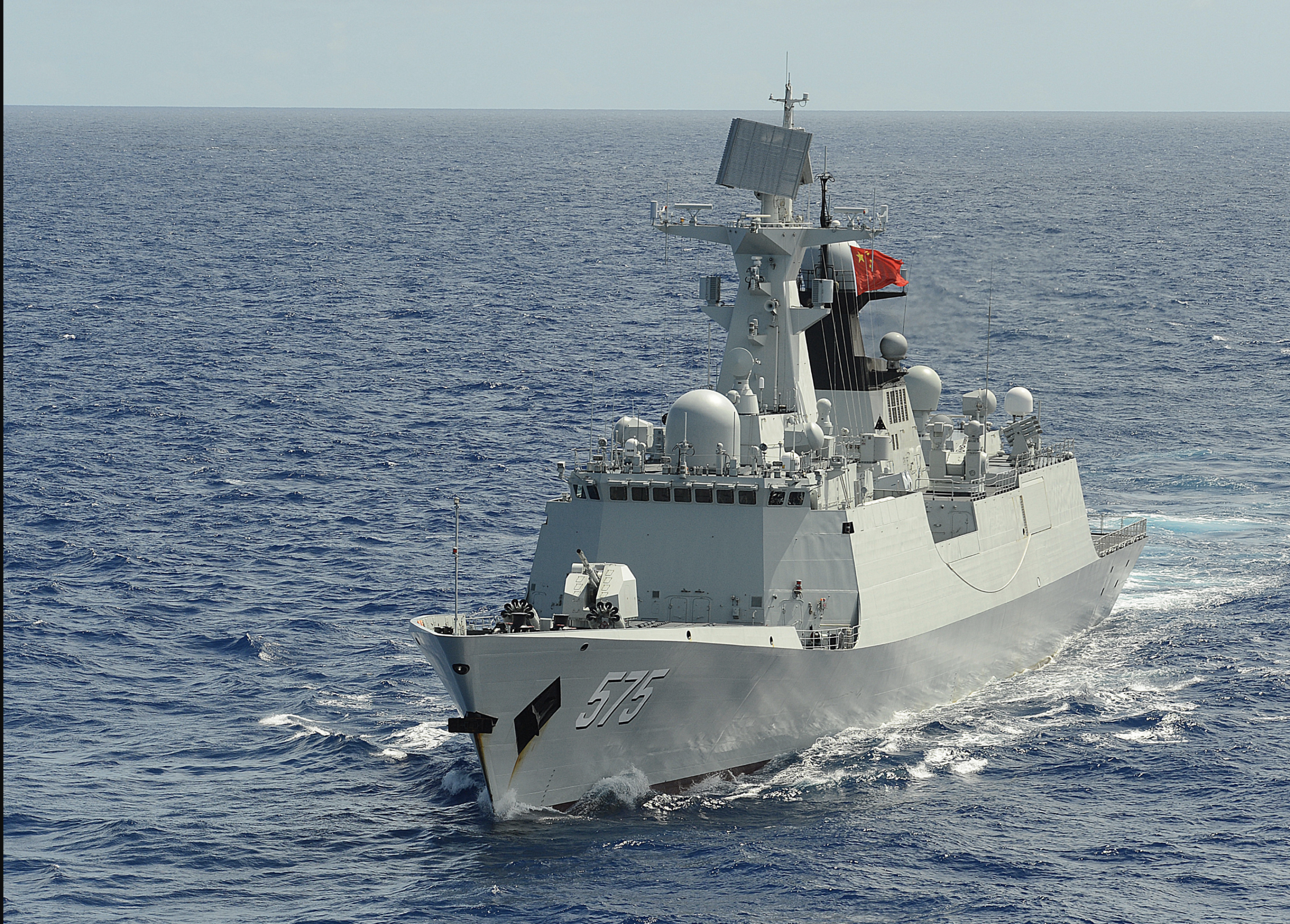
Chinese research vessels conduct surveys off the Alaskan coast inclusive of the U.S. Arctic Extended Continental Shelf, a seabed extending around 200 nautical miles from shore claimed by the United States. In August 2025, five PRC research ships simultaneously conducted research in the U.S. Arctic waters. Embedded in scientific crews are PRC People’s Liberation Army Navy (PLAN) personnel that are part of the ships’ complement. Scientific expeditions are also escorted by PLAN or PRC Coast Guard vessels. The same scientific expeditions that gather oceanographic data and conduct experiments provide the PLAN with opportunities to enhance the operational proficiency needed to employ nuclear submarines and icebreakers to project power in the Arctic Ocean. In 2025, as if to illustrate this point, the PRC deployed three icebreakers on Arctic expeditions. The surveys could provide the PRC with results to aid submarines and unmanned underwater vehicles. Acoustic and radar studies of sea ice can yield data that could inform the military’s AI-enhanced systems for study and planning. Very deep research can also provide the PRC with data to design manned or unmanned submersibles capable of operating at extreme depths. Submarines that operate at extreme depths can take advantage of subsea canyons and seamounts to mask their presence.
A PRC expedition to the Gakkel Ridge in the Arctic depths has demonstrated the PRC’s ability to deploy deep-sea crewed submersibles beyond 5,000 meters depth to explore the Arctic seafloor. The deep-sea crewed submersible Fendouzhe conducted 40 dives in parallel with an icebreaker, which ensured the submersible was not trapped under sea ice. The PRC has taken deep dives with the Fendouzhe to greater depths (almost 11,000) in 2020 at Challenger Deep. The 2025 mission was accompanied by another submersible, Jiaolong, and a fleet of five scientific vessels, one of which was an icebreaker. Although exploration of thermal vents was the given explanation for the dives, sonar and cameras were employed to map the region with great detail. Curiously, the PRC science expedition declined to release its data for wider scientific inquiry. This undercuts PRC justifications for its wide-ranging seafloor scanning expeditions and oceanographic survey projects. Again, civil-military fusion shapes how data is retained or released. If there is a strategic military value information will not be shared.
Climate Change and Economic Opportunities Will Create Opportunities and Increase Risks
Passage through the Bering Strait is normally restricted to open-water travel between May and November, with some variations. Icebreakers can increase access, and the PRC is on an ambitious program of icebreaker construction with Russian assistance. Recent ship passages through the strait are nearly twice those of the prior decade even though monthly ship passages number fewer than ten per month. Although the International Maritime Organization (IMO) Code for Ships Operating in Polar Waters (the Polar Code) came into force in 2018, international signatories are responsible for enforcing it. This is an opening for PRC lawfare and an expanding role for its Coast Guard and PLAN forces.
Dominating the Global Seafloor is a Key PRC Strategic Goal
PRC efforts to establish control over seafloor resources, including rare earth and strategic mineral nodules, are more advanced than those of other global competitors. The PRC has the world’s largest fleet of civilian research ships, and underwater sensors that gather data on ocean temperatures and salinity and map the seafloor. PRC state-owned firms also control 86,900 square miles of seafloor through five contracts recognized by the United Nations-founded International Seabed Authority (ISA). Only 31 ISA contracts have been released worldwide, and just 22 contractors have been awarded exploration rights. The PRC has taken its licenses and developed a mapping program with alacrity, systematically mapping areas with hundreds of underwater sensors and buoys. Notably, the PLAN-affiliated mapping ships reportedly regularly stray outside China’s approved waters, with over 94% of such violations occurring at strategic points in the Indian, Pacific, and Arctic Oceans. The PRC should continue surveys outside of legally approved areas, especially where there is seafloor wealth or strategic data, under the cover of economic or science-related experiments or surveys.
Scenario One: Undersea Defenses and Irregular Warfare Weapon Systems Will be Employed by PRC Forces in the Arctic
The PLA’s “Transparent Ocean” initiative is a strategic initiative that the PRC is using to create and link a five-layered network of early warning systems that span from space (satellites) to the seafloor, with unmanned surface ships, unmanned underwater vehicles, seabed sensors, and AI-enhanced data centers. PRC scientists from Zhejiang University and the China Academy of Sciences, two academic institutions with connections to Arctic projects and the PLA, are working on projects to support this network. Although the South China Sea is the most likely emplacement area for this effort, the Arctic could prove a rich operational environment for data systems. AI-enhanced data systems will collect data, test assumptions, and develop anti-submarine routines that could be transmitted to subsurface, surface, and mine threats capable of swarm operations. One example of climate data that is valuable to military observers embedded in PLA scientific expeditions is the impact of sea ice melt on warming. An Alaskan newspaper reported that changes in Arctic ice melt and freshwater influxes are creating noise that could affect United States military acoustic sensors. Scientific expeditions that gather information about salinity, currents, and undersea topography generate data that AI-intelligentized weapons can use for acoustic, magnetic, and optical targeting. The same techniques the PRC is employing in the Paracel Islands could be used in the Bering Strait or near the Alaskan Aleutian Islands.
Seafloor maps would support a future combat scenario in which the PRC, for a short time, could impose losses and delays on forces seeking to use the Bering Strait and its adjoining waters. Still, they may not be able to sustain control of a chokepoint. PLA scientists have conducted oceanographic surveys of the Arctic over the last ten years, accumulating knowledge of the subsea domain that planners could use to site naval mines along likely approaches into the Pacific through the Bering Strait. Chinese maritime doctrine identifies mines as an effective means of denying an adversary freedom of movement and as a form of warfare well-suited to irregular forces or clandestine groups. AI-controlled advanced undersea mines could utilize acoustic signatures gathered by PRC scientific vessels to target military craft and submarines while avoiding attacks against civilian sea lane traffic.
A disturbing component of PLAN minelaying is the prospect of civilian cooperation to supplement military assets. Each PLAN regional command has organized militia units for missions, and the PRC 2008 defense white paper explicitly mentions that reserve forces are likely to be involved in mine warfare. PLAN doctrine further confirms the militia’s role in the PLAN Mine Warfare /Mine Counter-Measure journal Sea Mine Warfare and Ship Self-Defense (水雷战与舰船防护), which provides a thirteen-point recommendation for how to employ mines. Among the guidance is the principle of 先制, or “First Control,” through clandestine mine-laying to gain a surprise advantage. Militia vessels could lay mines in areas where seafloor data scanning has confirmed as advantageous by civilian ships modified for this purpose, their unobtrusive shapes eliciting little interest. The exact composition of such units is unknown, but the influential Chinese book Unrestricted Warfare recommends a mix of units to change the tone and predictability of war. In addition, combining various forms of warfare is proposed to disrupt the advantages of a conventionally minded foe. The PRC defines national security as an integration of economic, legal, cyber, and diplomatic power alongside military forces. Utilizing economic (resource), scientific, and guerrilla (unconventional war) capabilities would bring the PRC’s scientifically garnered data into planning, targeting, and early warning plans and preparation.
Another system that will likely be used in conjunction with subsurface sensors, mines, and unmanned vehicles is drones capable of Arctic operations. The drone programs that China and Russia are developing benefit from experience gained from Russia’s combat in Ukraine. Although China assists Russia with production and sanctions evasion, the PRC also benefits from its alliance with Russia through its own research and development programs that incorporate Russian lessons learned. China is learning how to use autonomous drones for ISR, logistics, casualty evacuation, and persistent patrol presence.
PRC Arctic research can serve dual-use purposes and should be suspected of having direct government links to the PLAN, which may use any information of strategic value. This includes research conducted as part of an international team. The information on ice, sea salinity, and competing naval forces will be useful for China’s Shang 3 (Type 093B) Class Nuclear Attack Submarines, which were built for Arctic use. The data gathered from scientific missions could be used for wargames before submarine operations, or integrated into the research, development, and ultimate deployment of the Shang 3 attack submarine. Knowing the undersea topography and how to operate in areas where US sensors are degraded could provide PRC vessels with a tactical advantage during the open phases of conflict.
Scenario Two: Economic ventures and scientific expeditions will become rationale for permanent PLAN and Coast Guard presence in the Arctic
The PRC’s 14th Five-Year Plan calls for significant research into the Arctic and its environment. The Ministry of Science and Technology has established guidelines for funding polar-capable unmanned amphibious vessels, deep-sea polar research projects, and projects directly related to Beijing’s Polar Silk Road ambitions. According to the Science of Military Strategy, the projection of military power towards the Arctic must progress with extreme caution and, at least initially, exploit the legitimate cover provided by military-civil fusion projects. Sensor emplacement could be part of the gradual buildup of military power and early-warning networks for the PRC and the PLAN. Sensors could be positioned during expeditions by unmanned undersea drones or deep-sea submersibles.
PRC polar ambitions include integrating Arctic sensors with its BeiDou satellite system, especially those that can provide information on sea ice, navigation, and undersea conditions. The projects also mention “high resolution microwave sounding and aerial remote sensing,” in conjunction with “30 charts for the Northwest Passage and “nautical charts covering more than 80 percent of the Northwest Passage.” The PRC also plans to study and understand how the international conventions and regulations govern Arctic shipping routes. In the course of “building up Arctic expertise,” the PRC plans to form polar cooperation agreements with Arctic states. The PRC has already announced its intention to use the Northwest Passage for commercial traffic.
Scientific expedition justifications anchored on claims of information gathering for the benefit of all or the PRC’s economic ambitions are not enough to give the PRC an enduring military presence in the Arctic. However, Coast Guard vessels and icebreakers blur the lines enough to provide the PLAN and PRC planners with information on pressure, temperature, salinity, and currents. At the same time, the PRC builds a submarine force capable of operating in the Arctic. A lack of US icebreakers hinders monitoring and contesting PRC efforts to increase its Arctic presence.
The PRC’s deployment of five icebreaking research vessels near Alaska in 2025, including the PRC’s most powerful icebreaker, the Xue Long 2, alongside oceanographic research ships from China’s State Oceanic Administration, a deep-sea submersible deploying vessel, and the long-endurance icebreaker Tan Suo San Hao signals the PRC’s intent to establish an enduring presence in the Arctic region. PRC ships have been tracked moving through Russian waters and visiting ports including Murmansk. It is unclear how many new icebreakers the PRC will build;. PRC and Russian designers have reportedly been developing nuclear-powered vessel designs similar to Russian types since 2019. The PRC’s push for nuclear icebreaker development bodes well for powerful ships capable of operating for long periods at sea without being tethered to refueling or resupply.
As the PRC builds its fleet through cooperative programs with Russia, the US launch of its Arctic Security Cutter shipbuilding program, following the creation of the 2024 Icebreaker Collaboration Effort (ICE) Pact, promises 11 new Arctic vessels to enhance US maritime security in the Arctic. As of 2026,, the US icebreaker fleet for the Arctic consisted of a rotational group of two aging vessels and a new medium icebreaker. Although the deliveries of Arctic Security Cutters are not scheduled to be complete until 2025, new vessels are projected to begin joining the Arctic patrols by 2028. However, the new icebreakers will also be subject to a dual mission: Arctic icebreakers are programmed for Antarctic missions as well.
The PRC’s possession of multiple icebreakers provides it the necessary tools to facilitate scientific exploration and freedom of maneuver in the Arctic year-round. However, the opening the PRC requires to establish a rotating and permanent presence in the Arctic could be the recently signed maritime law memorandum of understanding between the Federal Security Service of Russia and the Chinese Coast Guard. The Chinese Coast Guard could justify its presence as a law-enforcement body ensuring freedom of navigation, while also participating in the occasional naval exercise with Russia. In addition, the European Union’s plans to lay two new cables linking Europe to Asia could provide the PRC with opportunities to assist with the projects or monitor cable deployment while engaging in scientific research.
The EU, in a 2026 report, identified new Arctic undersea cable connections as a high-demand initiative for Europe. The EU plans a Far North Fiber cable to link Europe and Japan via the North-West Passage, and a prioritized Polar Connect cable to follow a direct route through the North Pole towards North America and East Asia. Presently, the EU lacks the resources to quickly pursue a cable-laying program and a follow-up support program to have vessels available for repairs that sea ice may necessitate if it cuts cables. The PRC has the vessels to support a program of this magnitude, and if it chooses to lay its own cables, it could use its existing law enforcement agreements to claim rights of protection for its ships.
Scenario Three: The PRC will make claims to undersea resources and territory in the Arctic and utilize existing laws and protocols to map the region illegally
The PRC’s history of employing lawfare to justify its aggressive measures taken within other states’ maritime domains is well known. Ship movements, ostensibly to find fish or to conduct freedom-of-navigation exercises, have been used to explore training areas and sea lanes. Research vessels have also deployed drones, submersibles, buoys, and sonar to map the seabed and areas of questionable scientific value, despite PRC claims of lawful access under the United Nations Convention on the Law of the Sea (UNCLOS). The results of the manipulation of UNCLOS and outright obfuscation of its goals will complicate efforts to prevent the PRC from illegally gaining data that its military can use to plan for future wars.
The seafloor is economically strategic, and the resources located on its surface are vital to modern high-technology business. The potential for global power competition to play out on the seafloor is growing as resource concentrations are mapped. The seafloor’s irregular surface can also hide a plethora of irregularities. Mapping it will be the first step toward establishing control and territorial claims that extend beyond state EEZs.
Mapping the seafloor and developing a highly detailed understanding of undersea currents, salinity, and temperature is valuable to commercial enterprises as well as future PRC nuclear submarine traffic. When companies employ remote mining vehicles and undersea drones, knowledge of these seabed environments will help determine where and when to commence mining operations. The PRC has invested heavily in the International Seabed Authority, and the US lack of support for the United Nations Convention on the Law of the Sea gives the PRC a position to advocate for change in replacing the “outdated maritime order (落后时代的旧海洋规则) with a new one based on multilateralism and equality.”
The National Deep Sea Centre (国家深海基地) under the PRC Ministry of Natural Resources (自然资源部) employs claims of scientific research to advance territorial claims, and research vessels have violated EEZs to conduct deep-sea exploration. The PRC uses its membership in international organizations to assert its claims, deny others’, and gain an advantage despite violating the same rules and norms it claims to champion. Taken in that sense, the simple act of planting a flag on the seafloor can be seen as a prelude to asserting authority on an area previously disputed or unclaimed by a sovereign nation.
Despite not seeking an active seat at the ISA table, the Trump administration recognizes the economic viability of mining undersea resources. The April 2025 release of Executive Order 14285 declared that the US would develop capabilities in seabed mining, mapping, and deep-sea technology, and create partnerships to challenge PRC seabed mineral resource prospecting. In parallel with prospecting, the possibility of the PRC joining Russia as the second nation to reach the Arctic seabed would give it a claim to the disputed seabed and its mineral wealth. The PRC could leverage an event of this sort to justify its near-Arctic power claim and further justify its determination to gain access to oil and minerals in the Arctic. The pattern of PRC undersea mining and mapping indicates a systemic attempt to identify, exploit, and monopolize resources wherever and whenever possible, especially in areas where states lack the capacity or will to prevent PRC overreach.
Scenario Four: PRC undersea drones and surface vessels will tap or cut submarine cables as a prelude to conflict
The PRC has an advantage in the number of Chinese-flagged cable-laying ships and their potential to conduct espionage beneath the waves. Companies like the PRC-state-controlled S.B. Submarine Systems repair submarine cables and could clandestinely tap them for information. The same ships are reputedly engaged in questionable practices, such as hiding their locations from radio and satellite tracking services while operating in sensitive areas of the South China Sea. Such ships could aid in seabed cable location and cutting, or, in preparation for conflict, gather intelligence from cables carrying classified US military data. The frequency of PRC vessels implicated in cable incidents in the South China Sea (27 suspected incidents since 2018), serves as warning to PRC intentions for undersea cables in case of conflict. The implications for the US and allies are dire when such incidents are generalized to include the Arctic region. The implications for the US and allies are dire. Limited cable repair ship numbers and availability constrain worldwide cable repair capacity. In addition to anchor-dragging incidents, the PRC has been developing methods to cut cables and tap into them for intelligence purposes.
The PRC is suspected of deploying underwater drones to surveil submarine cables and map maritime mobility corridors. Drones discovered in the Philippines are suspected to be tied to the passage of research and PLAN vessels over areas with cables. PRC research vessels have also allegedly employed remote-controlled cable-cutting machines to sever undersea cables at depths of up to 3,500 meters. Although the cable cutting machine is reputedly for oil and gas missions, similar PRC cable cutters have demonstrated the ability to sever 38-inch cables and with-inch pipes in twenty minutes.
Underwater cables are the veins that carry the world’s internet and connect the world’s economies, carry classified information, and in the case of conflict, could be among the first targets of warring powers. Natural causes can damage underwater cables, but recently they have been damaged by dragging anchors. Submarines or surface ships could also target them. If cables are mapped before an attack and left unguarded, they are a likely target. The underwater cables in the Arctic and immediately adjoining regions are few in number and could be isolated and cut. Arctic cable cuts could affect communications across multiple regions because of the low density of cable and length of cable lines through the Arctic.
Newer cables may also be at risk. The “Polar Connect Cable” will originate in Norway, pass through the North Pole, and continue to Japan, South Korea, and the Asia-Pacific region via the Bering Strait. The 10,000 km distance between Norway and Japan would reduce latency and provide greater network resilience. Another such cable, the 14,000 km-long “Far North Fiber Project,” runs from the Nordic Countries to Japan via Greenland, Canada, Alaska, and the West Coast of the U.S. The cable will run through the Northwest Passage—the sea lane running through the Arctic Archipelago of Canada and south of Greenland. Other submarine cables like the Quintillion are invaluable to the US northern Alaska coast and provide vital data services to the oil industry as well as US military users. A 2025 break in the Quintillion cable, caused by sea ice, cut service to over 20,000 users in western and northwestern Alaska and forced many to rely on satellite internet. In the Arctic, repairs to cables could take months due to sea ice, darkness, and a lack of available repair vessels.
Latency slowdowns or complete loss of cable and satellite traffic could be a significant factor in a future conflict. PRC systems can interdict satellite systems, and in the event of a cable cut, the lack of information would be a military and a civil issue that the PRC could exploit. PRC doctrine does not demand the Bering Strait be barred. Holding the strait long enough to delay a US or NATO response could provide the PRC with a window of action in the Pacific. Although cutting a single cable would not stop submarines, it could reduce awareness of PRC teams operating from ground bases in the Arctic while they deploy sensors and targeting technologies.
Conclusion
The PRC will continue to use science, dual-use research and technologies, and international research agreements to aggregate data that will be militarily impactful for planners, weapons and ship designers, and undersea dominance. PRC scientific research in the Arctic has impacts that span from space to the deepest parts of the oceans. Applying new information and gaining strategic advantage are among the PRC’s goals for the many oceanographic surveys and hydrographic studies conducted in and around the Arctic. As a “strategic height,” the Arctic is being systematically explored, and its secrets incorporated into the PRC’s attempts to gain and maintain an Arctic presence that goes beyond observer status and into active participation with rights to resources and policy decisions.
The Arctic region is a strategic window to NATO, Europe, and potential pathways to material wealth. The PRC has announced its goals in its five-year plans, strategic documents, and various economic ventures, revealing an unambiguous plan to master the seabed’s resources and contours. The PRC is preparing resources for surface and subsurface exploitation of the Arctic. The ambitious building programs spanning icebreakers, underwater unmanned vehicles, drones, and unmanned surface vessels show a concerted effort to build upon the data that science has gathered. The PRC is putting sensors in place, uniting its commercial and military capabilities, and ensuring that, when conditions demand preparations for conflict, the data to support operations are readily at hand.
Disclaimer: The views expressed are those of the author and do not necessarily reflect those of U.S. Army or the Department of Defense.


