Lost Villages: Tracking Destruction in Myanmar’s Rakhine State | bell¿ngcat

Netherlands-based journalism and open-sourced intelligence outfit bell¿ngcat published a May 27 comprehensive report on their investigation into the devastation of villages and infrastructure in Myanmar’s Rakhine State, home to the majority of the country’s much persecuted Rohingya. The research identified 115 villages in the region as partially or fully razed since the 2021 coup and the outbreak of the Myanmar Civil War. Fighting in the region has been particularly intense of late as the Arakan Army (AA) slowly takes ground from the junta. The conflict has had a devastating toll on civilians, of whom half a million in the region (13% of the total) are displaced.
Satellite Intelligence
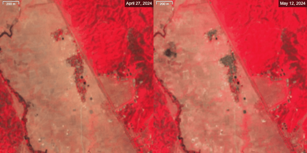
The report leans heavily on low and high resolution satellite imagery to track the status of villages, evidence of destruction (such as smoke from fires), and signs of fortification construction in contested areas. Particularly disturbing are images of the multiple Rohingya villages destroyed in 2017 during the crackdowns against the people in 2017– which analysts have labelled a genocide– rebuilt in the following years, and destroyed once again in 2023 and 2024. In a few cases, destroyed villages were turned into military outposts by both sides, underlining the inevitably long-lasting humanitarian tail of this five year war.
Themes
Centrality of Infrastructure: The report makes note of the centrality of the Kyaukpyu deep sea port, home to Chinese-built critical energy infrastructure and a military naval base. The city is effectively under siege by the AA. Almost all of the villages found to be destroyed in the region are within a 10km radius of the port.
Slipping Military Control: Conflict in the region is slow and destructive, but the evidence suggests a study wearing down of the military’s control. Kyaukpyu is no longer immune from AA attacks. In April’s sham election, voting was held in only three of the 17 Rakhine townships still under junta control. Those are Kyaukpyu, Sittwe and Manaung. The report points to an expected push against Sittwe before long– a symbolic regional capital.
Air/Drone warfare concentrated in military-controlled regions: Drones and aerial bombing are an important piece of this conflict, but the data reflects a more concentrated use than in other conflicts. Instead of employing drone and offensive aerial assets in rebel-controlled areas, the military seems to be using them more as part of their defensive ring, in the townships they still control. This suggests either a certain lack of those assets, a dedication to holding and consolidating their remaining territory in the region, or a combination of both.
While you’re here:
Check out our recent Discourse on Hayden Weatherall’s article for GSSR on how a Chinese pipeline, which originates at the deep sea port of Kyaukpyu, is helping aggravate and prolong the civil war. It is called: “A Chinese Pipeline is Prolonging Myanmar’s War | GSSR.” (The original article is titled: “The Pipeline That Fuels Myanmar’s War.”)
Here’s the original bell¿ngcat piece by Pooja Chaudhuri and Miguel Ramalho: “The ‘Lost’ Villages of Myanmar’s Rakhine.”