


Fire Detection as a Proxy for Combat: The Economist
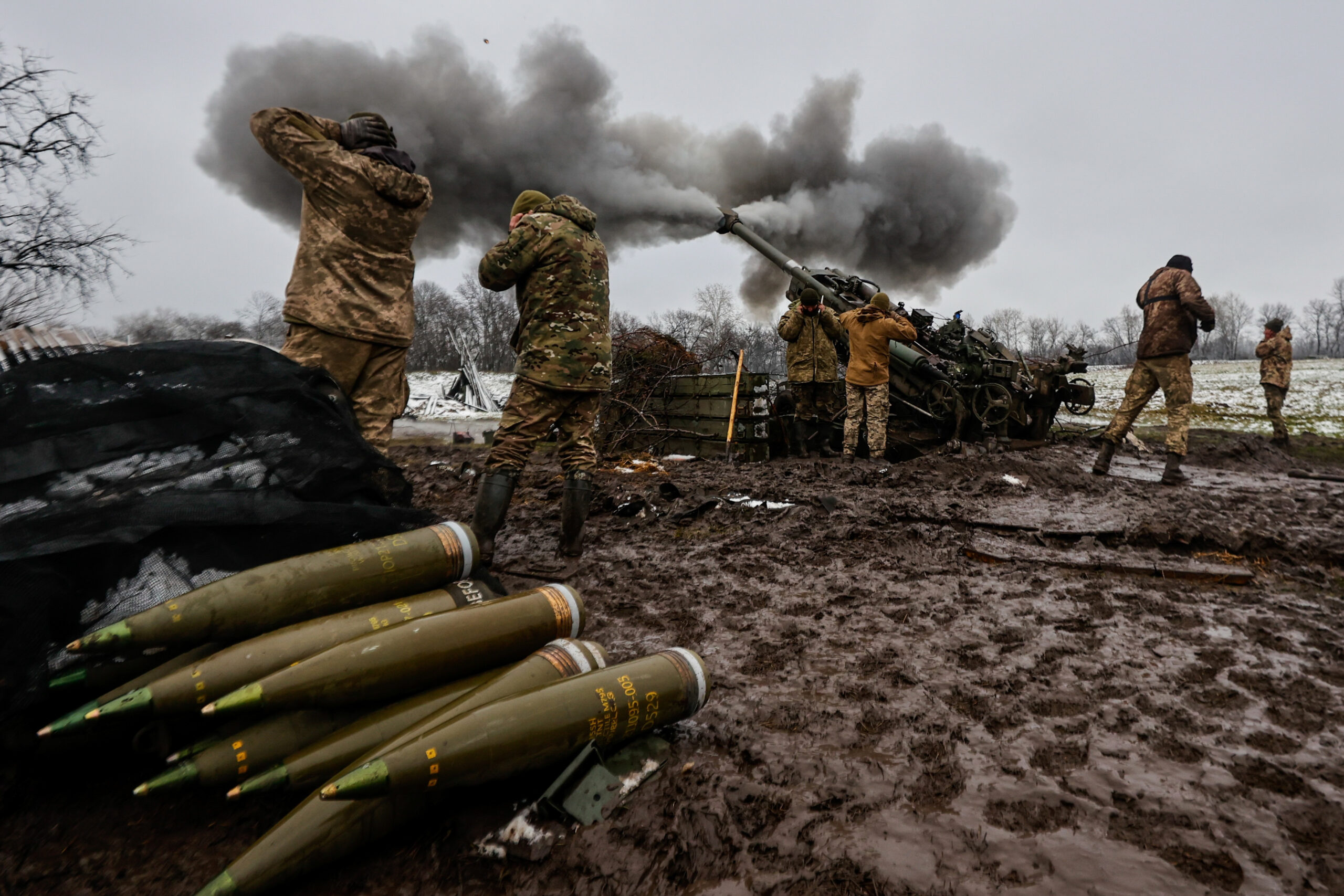

An analysis by The Economist called “Mapping the Ukraine war: where is the latest fighting?” uses satellite-based fire detection to estimate where and when fighting occurs in Russia’s war against Ukraine.
Using NASA’s FIRMS system, satellites pass over Ukraine roughly twice daily, recording heat signatures. Analysts applied a machine-learning filter composed of 100 models trained on pre-war fire patterns. Each model predicts expected fire activity in non-war conditions. When at least 95 of 100 models assess that observed fires exceed normal baselines, those events are classified as war-related.
This approach produces a standardized dataset that can identify likely artillery strikes, drone impacts, and missile attacks. A methodology of this sort shifts analysis from contested reporting to observable physical indicators, which offers a continuous and comparable measure of how the war is being fought.
Here are some specific takeaways from the report:
Interpreting Fire as Combat Activity
Each detected fire represents a probable instance of kinetic activity. Concentrations of fires indicate:
- Areas of sustained artillery exchange
- Locations of drone or missile strikes
- Shifts in operational focus over time
Because the dataset is collected uniformly, it allows comparison across:
- Russian-held vs. Ukrainian-held territory
- Time periods (24 hours, 7 days, 30 days)
- Changes in intensity rather than claims of advances
What the Data Shows
Territorial Control
- Russia controls 20.0% of Ukraine (net 12.8% has been seized since the invasion)
- Ukraine regained 93 km² in the past 30 days
Current Activity
- 3,368 war-related fires recorded in the last month
- Fire activity appears across both front-line zones and rear areas, suggesting geographic dispersion of strikes
Casualty Estimation Approach
There is no single authoritative casualty dataset. Instead, analysts combine:
- Fire intensity trends
- Observed territorial changes
- 200+ independent casualty estimates
This produces a meta-estimate of Russian losses over time. The results indicate:
- Total Russian casualties in the hundreds of thousands to over one million
- Daily death estimates that track closely with spikes in fire activity
Comparable estimates for Ukraine are not available due to insufficient data.
Data Limitations
Cloud cover can obscure satellite visibility. Some fires are missed entirely between satellite passes. Others may be misclassified, though strict thresholds reduce false positives. Finally, not all combat produces detectable fires. This is why the dataset is best understood as a consistent indicator of activity, not a complete record.
This article is accessible with a paid subscription to The Economist.
Access The Economist’s code, data, and models for the project on Github.